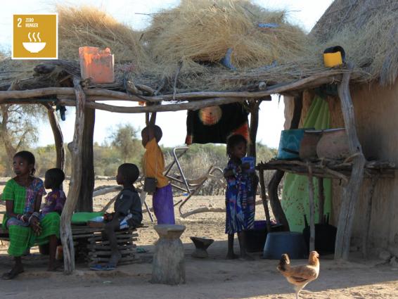
The majority of people who are food insecure live in developing countries, where nearly 13% of the population is undernourished. Sub-Saharan Africa remains the region with the highest prevalence of hunger, with the level increasing from 20.7% in 2014 to 23.2% in 2017. Zero Hunger is the second Sustainable Development Goal (SDG) and goal of the month for October 2019. The goal aims to end hunger, achieve food security, improve nutrition and promote sustainable agriculture.
The Rio+20: The Future We Want and 2030 Agenda are calling for reliable geospatial information, including data disaggregated by geographic location, in order to track progress and report on the SDGs as well as for monitoring risk assessments. The SALB programme provides that reliable data on administrative boundaries, disaggregated to the sub-national level.
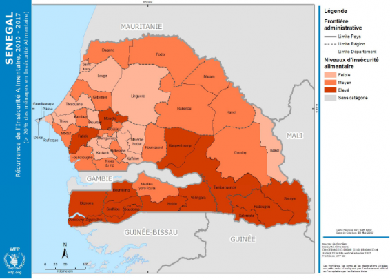
The standardized and readily available data from SALB is used as a critical reference by WFP to monitor high risk food insecurity areas and target humanitarian food supplies. For example, the authoritative geospatial dataset on administrative boundaries for Senegal, provided by the “Direction des Travaux Géographiques et Cartographiques, Agence Nationale de l'Aménagement du Territoire” (ANAT) and standardized in the context of the SALB programme, was used by WFP to generate its Food Insecurity Recurrence map, 2010 to 2017. In Senegal, thousands of people are facing a food crisis due to lack of rain and meagre harvests leading to empty stocks and food security threats. This Food Insecurity Recurrence map allowed WFP to show the regions most affected by this food crisis in Senegal by showing households with over 20% of food insecurity. WFP can then easily break this down into departments (the 2nd administrative unit below national level) to identify the priority areas for food assistance as well as nutrition and resilience programmes.
WFP and SALB have recently started to join forces and develop joint workflows to leverage respective strengths, in particular to maximize the benefit of the approach of the SALB programme’s validation process by the national geospatial authority and the standardization of administrative data while taking advantage of country office’s presence of WFP and data processing support at Headquarters. As a demonstration of this ongoing collaboration, WFP invited the SALB programme to be presented at its First Global GIS Workshop in Rome from 21 to 25 October which welcomed WFP’s country and regional offices representatives.