The United Nations Sustainable Development Goals (SDG) 3 on “Good Health and Well-Being” includes reducing the rate of malaria per 1,000 people by 90 percent from 2016 to 2030. According to the 2021 World Malaria Report, there were an estimated 241 million malaria cases in 2020 with 95 percent of them in Africa. World malaria day is celebrated every year on 25 April through the World Health Organization.
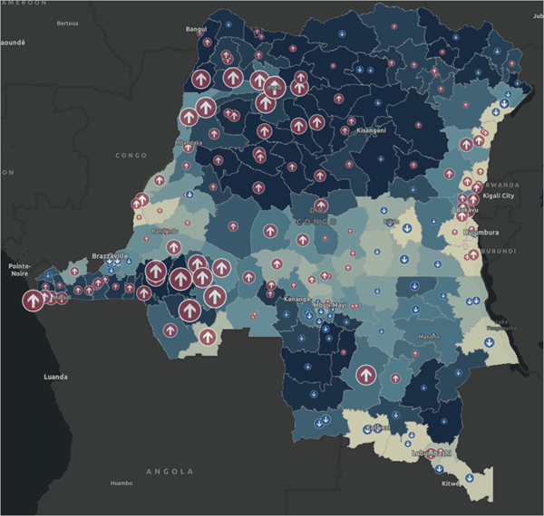
As a showcase of how to use mapping for monitoring progress on eradicating malaria, Esri developed a learning tutorial on how to prepare data and insights on where prevention and aid are most needed, and to calculate the incidence rate per 1,000 in accordance with the SDG reporting. The tutorial puts you in the role as member of the Ministry of Public Health for the Democratic Republic of the Congo assigned to monitor progress on eradicating malaria. The tutorial details how the data from the Second Administrative Level Boundaries (SALB) programme of the United Nations for the Democratic Republic of the Congo and from the Malaria Atlas Project's are processed and used to visualize and to monitor progress on eradicating malaria.
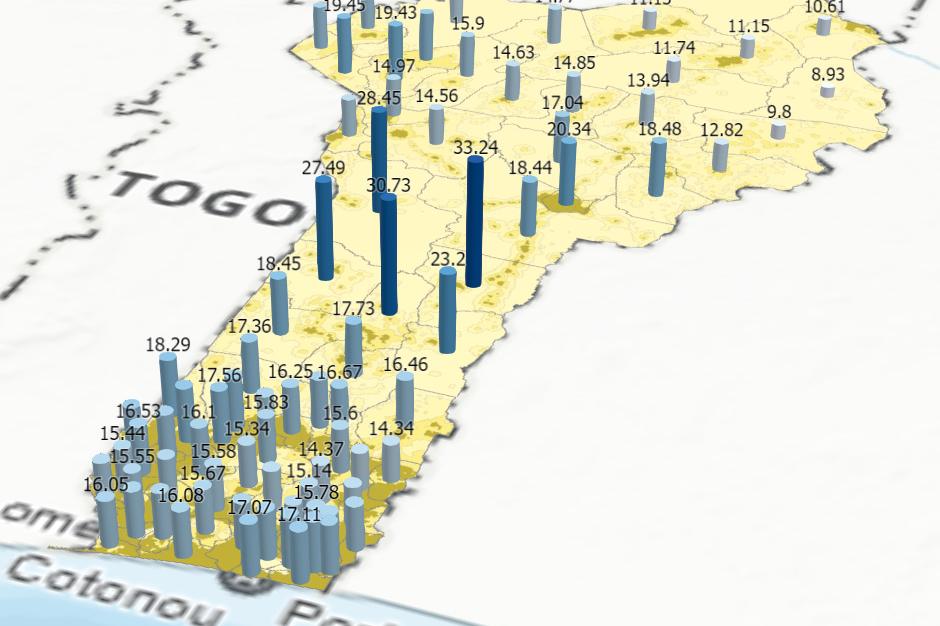
The tutorial map output shows the significant value data provides to support decision-making for the acceleration of the implementation of the Sustainable Development Goals in providing insights to better target populations, places, operational programs and investments for malaria eradication. These showcases also show the value of how disaggregated geospatial information must be brought to bear to understand phenomena within countries and spatio-temporal trends of our society, environment, or economy.
The tutorial is also a great example of the global partnerships needed to make available reliable data for collecting, extracting, processing, analyzing, visualizing the Sustainable Developments Goals. The dataset from the SALB programme was collected and processed in close collaboration with the Institut Géographique du Congo, responsible for the administrative unit’s data of the country.
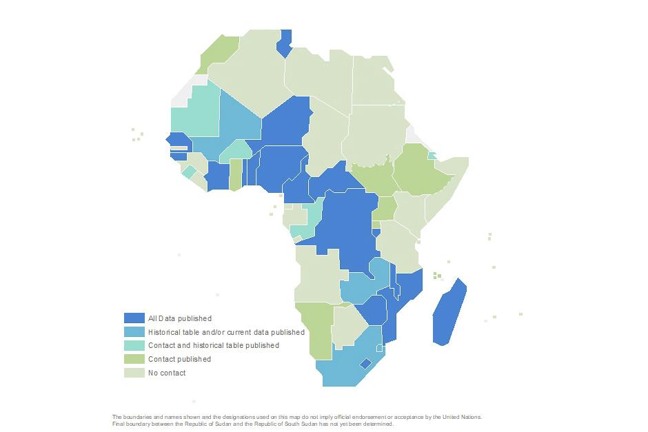
Common geographies made accessible through the SALB programme are an essential enabling component of the analysis on malaria and can be used to monitor virtually all the Sustainable Development Goals. Progress continues for the availability of common geographies, particularly over Africa with latest data available now for Mauritania. The SALB programme was once again presented during the Ninth Session of UN-GGIM Africa, including the tutorial on mapping malaria, to ensure the continued availability of latest geographies over Africa.
Screenshot of the map of the rate of malaria cases per 1,000 people in 2016 and percent change in 2020


