Administrative boundaries have been highlighted as a priority “core global fundamental geospatial data theme” by the Committee of Experts on Global Geospatial Information Management (UN-GGIM) Working Group on Global Fundamental Geospatial Data Themes. The UN-GGIM encouraged Member States to contribute data to the SALB programme (Decision 7/104 (e)). In Africa, the African Action Plan on Global Geospatial Information Management (2016-2030), supported and published by the Economic Commission for Africa, incorporates the objectives of the SALB programme as one of its Action Plan key pillars.
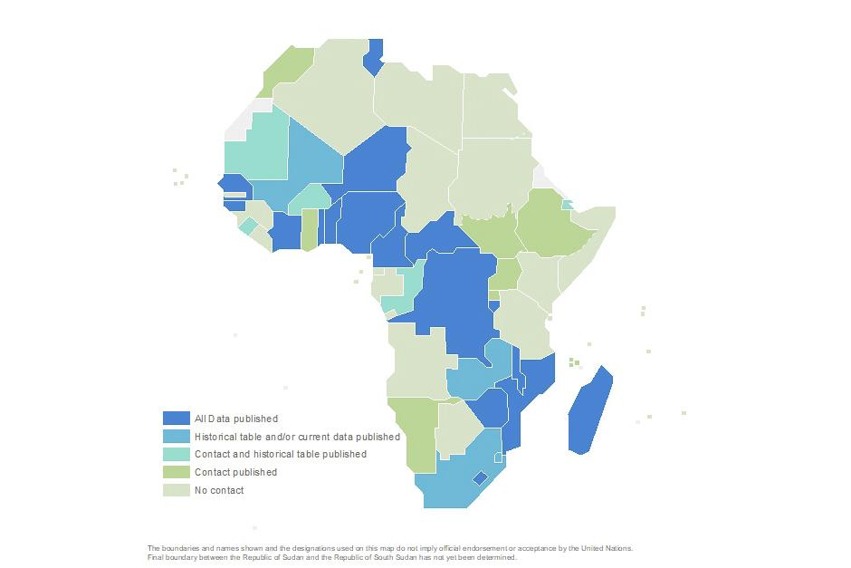
Consistent and accessible administrative units, or common geographies, as collected by the SALB programme are vital for the consistent aggregation, processing, measurement and tracking of national development priorities, they are also key in the dissemination of all forms of data, including statistical data, and enable to visualize progress on the Sustainable Development Goals and other global agendas. Many Member States from Africa have provided their national point of contact, published their geospatial datasets and historic tables. Despite remaining challenges for a complete coverage and currency, Africa is on its way to have continental coverage with datasets on administrative boundaries as can be attested in the map showcasing the current status of completion. It is to be noted that West and Central Africa have made significant progress which now facilitates cross-country analysis such as on health.
The progress is the result of several years of tireless focused and concerted efforts between the Secretariat and the Economic Commission for Africa to advocate for the promotion and the wider availability of common geographies over the continent. At last session of UN-GGIM Africa in October 2023, thanks to the support from the Bill and Melinda Gates Foundation, over twenty countries were sponsored to attend the regional proceedings of the Committee in Addis Abeba. The meeting offered the opportunity to discuss the purpose and value of the national owned data for the international community and the details of the implementation of the programme. Most importantly, the discussions allowed for a better understanding by National Geospatial Authorities of the need for their participation to the SALB programme. Following these interactions and further exchanges, there are now few more countries with their data available online and the programme few steps closer to a pan-African dataset on subnational geographies !

