The Regional Committee of the United Nations Global Geospatial Information Management in Africa (UN-GGIM Africa) was held in-person in Abidjan (Côte d’Ivoire) alongside the 13th edition of Africa GIS 2021 conference. The conference was an opportunity to resume of in person activities and events in Africa for then geospatial information and Earth observation professionals and, as customarily brought national delegates, professors, researchers, investors, businesses and practitioners from national, regional and international organizations. During this event, scheduled from 22 to 26 November 2021, a workshop was also organized prior to UN-GGIM Africa proceedings specifically on activities related to the SALB programme.
Invited by the Chair of UN-GGIM Africa through its Secretariat in the Economic Commission for Africa, the SALB programme facilitated the participation of 25 National Geospatial Information Agencies representatives from African countries to the conference and bringing the overall total of participants to UN-GGIM Africa to over 50 representatives from 27 countries. The SALB programme was able to support national representatives travels to these events through funds from the Bill and Melinda Gates Foundation, and facilitation by the Center for International Earth Science Information Network (CIESIN).
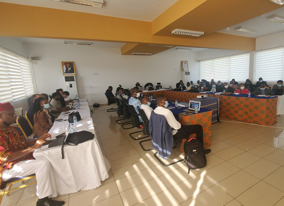
The workshop, on 22 and 23 November, started the sequence of the events and with open remarks from the Chair of UN-GGIM Africa, Mr. Oumar Ka from Senegal, the Secretariat of the UN-GGIM, Mr. André Nonguierma, and the Director of the Bureau National d’Étude Technique et de Développement of Côte d’Ivoire, Mr. Fernand Bale, as host to the events. The workshop focused on the value of geospatial information and its integration with statistics, and specifically the implementation of the SALB programme, as called for in the GGIM Africa Plan of Action.
To start the workshop, participants were briefed about the Global Statistical and Geospatial Framework and how it can contribute to create an enabling environment for the production and integration for geo-statistical information. Following on the introduction of the GSGF and its Five Principles, a presentation introduced how the SALB programme contributes to some of the principles including by:
- Providing agreed common geographies to display, store, report, and analyze social, economic, and environmental indicators across statistical datasets from different sources
- Availing geocoded units, data version, historical tables data and unique records
- Ensuring interoperability as per its agreed standards, processes, institutional approach and compatibility with more detailed coding schemas
- Sharing accessible and usable data with clear data custodians (the National Geospatial Information Authorities) and through a common platform, the SALB website
Further presentations were given on the SALB programme including on its objectives, processes, specification and methods. National Geospatial Authorities also shared their experiences and challenges on mapping administrative units, the use and interaction with statistical data, and the partnership with the SALB programme, this included presentations by Côte d’Ivoire, Madagascar, Mozambique, Togo, and South Africa. The case of Zambia was presented as part of the GRID3 programme showcasing capacity development to update and enhance a national administrative units’ geospatial dataset. Many countries advocated for further support in terms of capacity building and financing of national geospatial activities, including in updating and upgrading administrative units’ data. The workshop was a success for advancement of SALB programme, and for UN-GGIM Africa, in bringing together many National Geospatial Information Authorities to share experience and further strengthen their community. This was also a great opportunity to build a deeper understanding between participants and the SALB programme.
The overall proceedings of UN-GGIM Africa and Africa GIS conference was an opportunity for NGIA to keep up-to-date with latest trends on geospatial sciences and technologies; to increase their awareness on international frameworks and policies; develop further their professional networks and outreach to the wider geospatial community; and consider together their contribution to Agenda 2063: The Africa We Want and the 2030 Agenda for Sustainable Development.